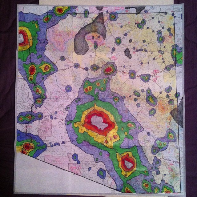
A Study In Arizonian Light Pollution
A couple tasks upon moving back to AZ: 1) star trails over Red Mountain (harder than I expected due to dang stupid airplanes)
2) hand color light pollution zones on a fold out AZ state road/topographical map
3) scout out the nearest grey zone site
#2 is in the bag. I was gonna make it a project to work on with my niece, but I quickly realized just how much of a perfectionist I was gonna be about it so I let her off the hook. I picked up a $3 map at the gas station on New Year's Eve and started work on it the next day. Using my Dark Sky Finder iPhone app created by Skidmore apps which uses data from the Jshine.net Dark Sky Finder (which cribs from the NOAA National Geophysical Data Center and the Royal Astronomical Society) I scribbled in the borders between the zones from white->red->orange->yellow->green->blue-> grey (grey zones account for most the map and were left uncolored or neutral)->black as they relate to the Bortle Light Pollution Scale.
And viola...in Prismacolor.
It took the better part of two days and bled into the middle of a first date, but hey - being a nerd is cute now, right? Anyway, next step is scouting out some grey zone sites and hopefully making it out by this summer to the black out zones above the Grand Canyon or east of Sunrise Ski Park on the New Mexico border, both on First Nations tribal lands. Go figure. Its a 5.5 hour drive either way, but I'd like to get a lot of shots of the center of the Milky Way under the best possible conditions - its a labor of love.
Oh, and #4) getajobbuyacarmoveoutofmyparentshouse
Fun Fact: ~80% of light pollution is caused by retailers, specifically the parking lots of the big box stores like Wal Mart, Target, etc. Dang capitalist pigs!
